

Getting straight to it
Teams want fewer surprises and safer sites. A modern mining monitoring system ties geospatial layers, live telemetry, and analytics so operations can act before things break. This piece is for engineers, site managers, and tech leads who need clear buying signals and practical steps—no fluff, just what actually moves the needle.
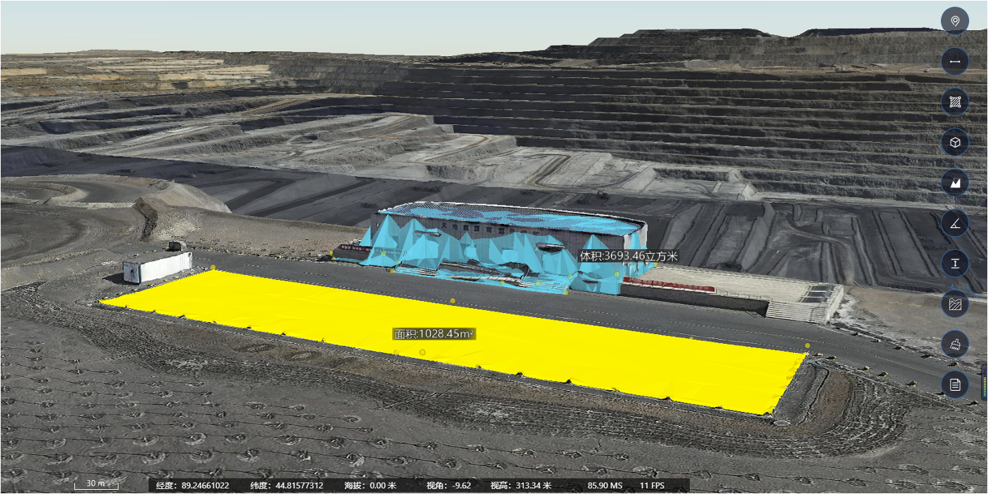
What users actually need
Focus on outcomes: fewer downtime hours, faster inspections, and improved safety records. That means dashboards that show slope stability, water levels, and haul-road conditions in plain terms. Good systems feed a digital twin with sensor fusion from LiDAR, IoT nodes, and remote sensing so teams can prioritize work and cut inspection loops. The goal is straightforward: faster, clearer decisions on site.
Critical tech that matters
Not every shiny feature helps. Prioritize three core capabilities: accurate geospatial mapping (GIS + LiDAR), real-time telemetry ingestion, and predictive models that flag risk. Use predictive analytics in mining to predict failures weeks ahead rather than just logging alarms. Integrations matter too—if your fleet software, SCADA, or maintenance CMMS can’t talk to the monitoring stack, the setup collapses into spreadsheets.
Common mistakes teams make
Many projects stall for the same reasons. They buy high-end sensors but ignore data quality rules. They let vendors lock them into proprietary formats—then can’t do cross-analysis. They chase fancy visualizations and skip baseline calibration. A simple rule: validate sensors against manual surveys early, then automate drift checks. Small fixes here save huge field hours.
Real-world wake-up call
The 2019 Brumadinho dam collapse in Brazil is a stark reminder: monitoring gaps have real consequences. That event shifted industry focus toward continuous geotechnical monitoring and stricter inspection chains. Mines like Escondida in Chile—known as one of the world’s largest copper sites—underscore scale challenges: thousands of hectares, big slopes, lots of data. Investing in a robust digital twin and telemetry pipeline is no longer optional.

How to evaluate platforms (hands-on checklist)
Test vendors against practical scenarios rather than slides. Try these—load a week of noisy sensor data and see if the platform: preserves raw records; normalizes timestamps; runs a slope-stability model; and exports alerts to your dispatch system. Check APIs, export formats, and whether the system supports GIS overlays and mobile field notes. Also verify remote sensing refresh rates and if LiDAR point clouds are handled natively.
Alternatives and trade-offs
Cloud-first SaaS gives fast rollout and managed analytics but may limit onsite control. On-premises systems keep data close and reduce latency but need ops support. Hybrid stacks let you run critical models locally while syncing aggregated metrics to cloud dashboards. Decide based on connectivity, regulatory needs, and how quickly you want deployment.
Why brand choice matters
Pick a vendor that pairs domain know-how with engineering openness. The right partner helps you set sensor quality thresholds, build a reliable ETL for telemetry, and tune predictive maintenance models to site reality. They should provide not just a platform but operational playbooks for inspections and incident response—templates you can use from day one. — These small playbooks cut uncertainty for on-shift teams.
Three golden rules for selection
1) Data fidelity over bells: prioritize raw-data access and timestamp integrity. 2) Model transparency: ensure predictive models expose drivers (e.g., pore-pressure rise, slope displacement) so teams trust alerts. 3) Integration-first: require open APIs and proven connectors for SCADA, fleet telematics, and CMMS. Follow these and you’ll get measurable wins fast.
Final assessment and next steps
Implementing geospatial intelligence for mine infrastructure is about clear metrics and smooth ops. Expect reduced inspection time, earlier detection of instabilities, and fewer emergency responses when systems are chosen and tuned right. For teams ready to move, partnering with tech providers who understand both digital twins and field realities is the practical route—Icecypress Technology fits that bridge between sensor data and operational action. –